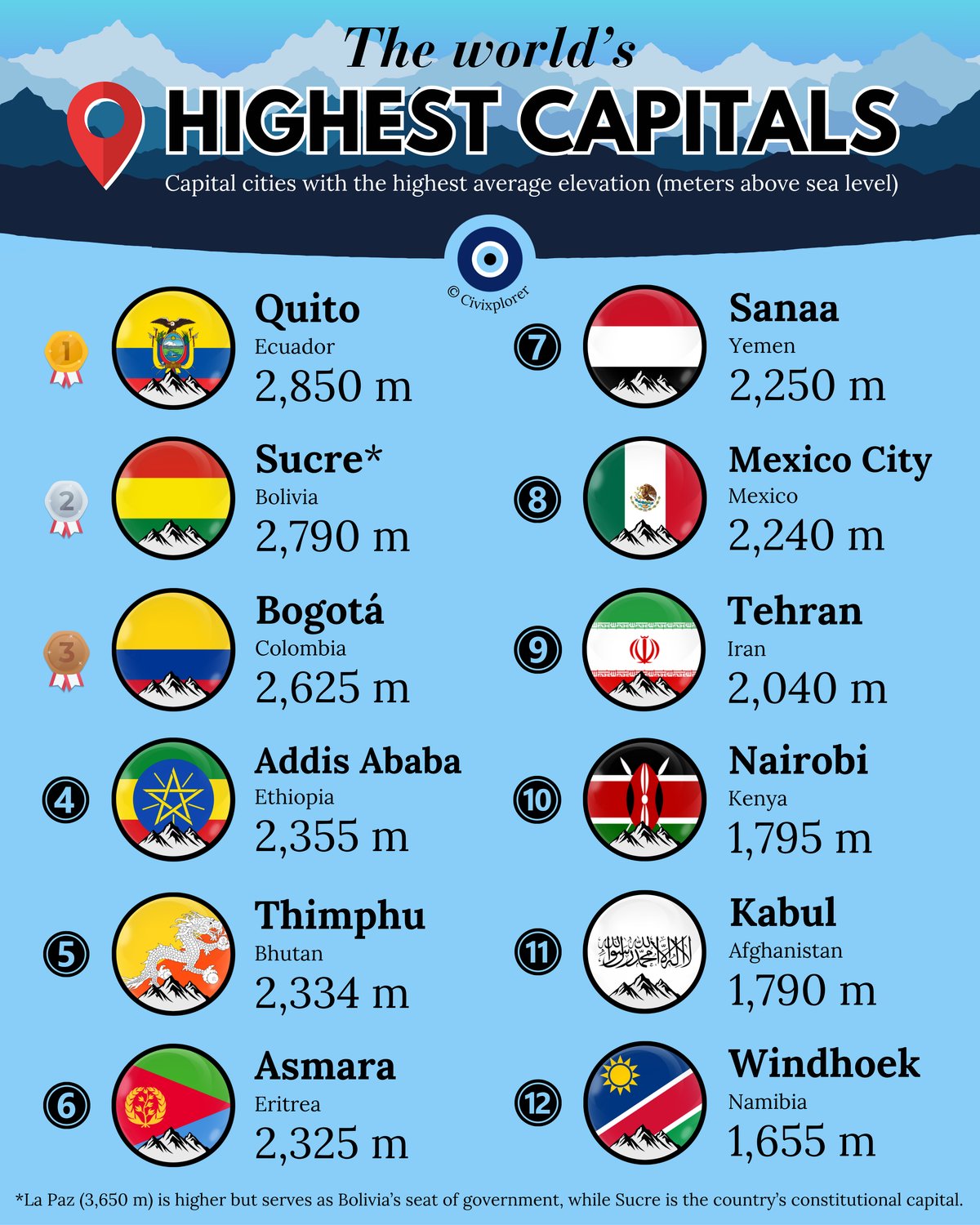
Outcome of the Scramble of Africa: Largest Cities in 1913
Africa’s urban landscape in 1913 revealed. Discover how the Scramble for Africa and indigenous roots shaped these historic metropolises. Explore the ranking now!

The eye of the world
Found 8 results for "British"
Africa’s urban landscape in 1913 revealed. Discover how the Scramble for Africa and indigenous roots shaped these historic metropolises. Explore the ranking now!
U.S. independence recognition was a high-stakes geopolitical game. Discover which five nations first backed the new republic and the motives behind their support.
America explained: explore the diverse cultural, linguistic, and geographic labels that define our hemisphere, from Latin America to the Anglo-sphere.
British Museum objects originate from across the globe, telling a story of empire and discovery. Explore the top nations represented in this world-class collection.
This map of the Thirteen Colonies reveals the geographic and cultural roots of the United States. Discover why these regions developed so differently before 1776.
The Flag of the Arab Revolt defined the Middle East's visual identity. Discover the poetic origins and British design behind these iconic colors.
World War death tolls reveal a staggering shift from industrial conflict to total war. Discover why the Soviet Union and China suffered such extreme losses.
British Empire city rankings in 1900 reveal a global web of power. From London’s finance to India’s trade, discover which hubs ruled the Victorian era.