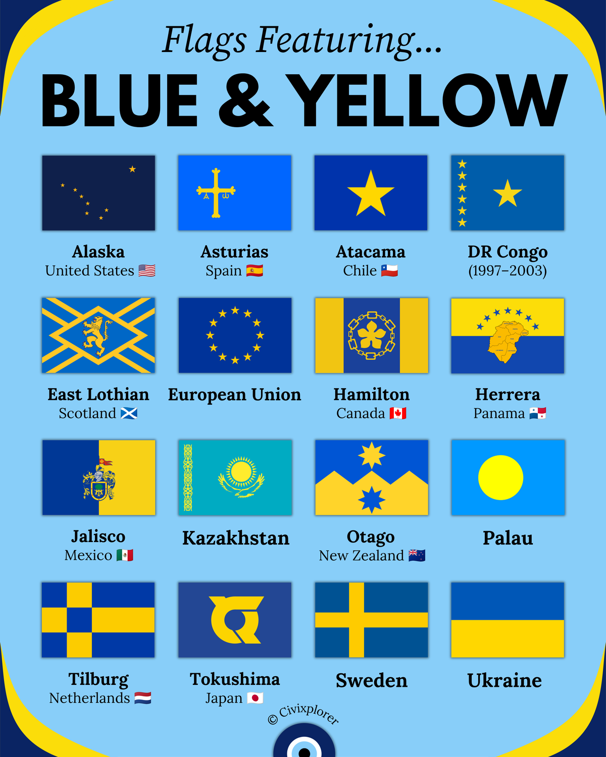
Imperial Shadows: The Scramble for Africa
Scramble for Africa 1913 map reveals how empires carved a continent on the eve of WWI. Discover the secrets behind the two nations that remained free.

The eye of the world
Found 6 results for "colony"
Scramble for Africa 1913 map reveals how empires carved a continent on the eve of WWI. Discover the secrets behind the two nations that remained free.
A collection of flags used in Brazil that reveal a 500-year journey from colonial rule to a modern republic. Discover the royal secrets and hidden meanings behind these iconic symbols.
France's longest land border isn't in Europe. Discover how French Guiana creates a 730 km frontier with Brazil and why this map redefines global geography.
Cultural fault lines define nations that are neighbors yet worlds apart. Explore why geography doesn’t always dictate identity in our latest map guide.
Iceland and Greenland naming history reveals a fascinating Viking marketing trick. Discover why these iconic names don't match reality in our latest guide.
This map of the Thirteen Colonies reveals the geographic and cultural roots of the United States. Discover why these regions developed so differently before 1776.
We rely on ads to keep this site free & running. Please disable your ad blocker and reload the page to continue.