
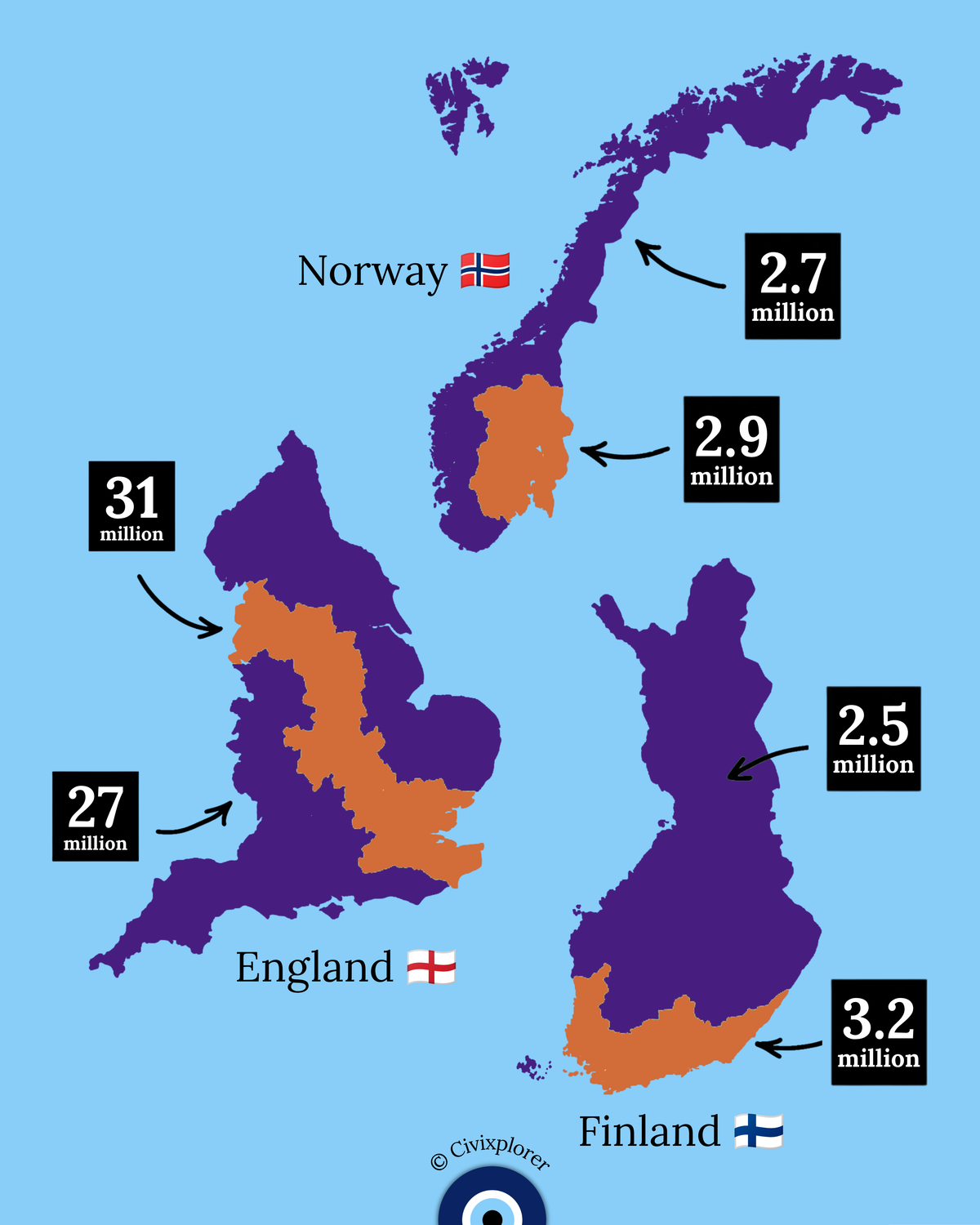
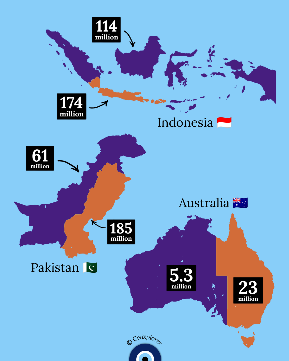
When examining a world map, it is easy to assume that a nation's citizens are spread evenly across its landmass. However, spatial population distribution reveals a striking reality: total territorial area tells us remarkably little about where people actually live. Across major nations, vast geographic expanses remain nearly empty while massive populations concentrate into narrow corridors, coastal fringes, and fertile river valleys. These extreme geographic divides are rarely accidental; they are the direct product of physical topography, climate constraints, water accessibility, and long-term economic development.
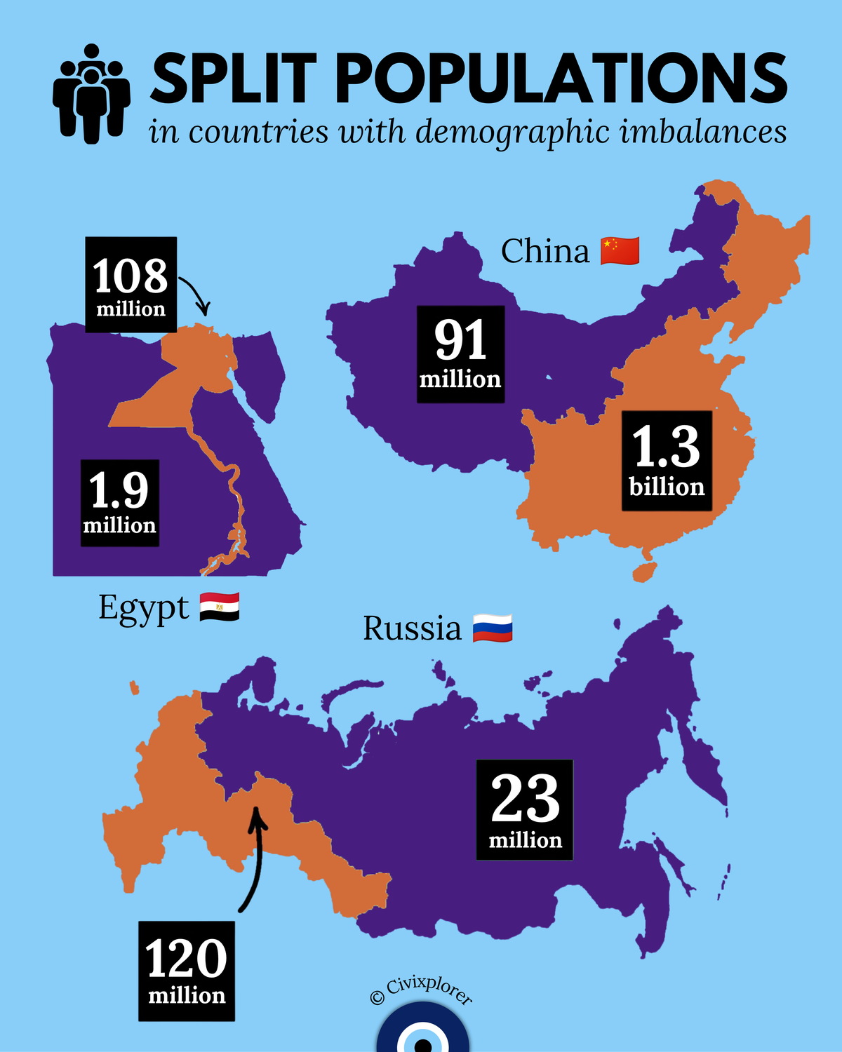
One of the most famous examples of this phenomenon occurs in China, where an imaginary diagonal line known as the Hu Huanyong Line divides the country into two distinct demographic halves. First identified in 1935, this line stretches from Heihe in the northeast to Tengchong in the southwest. The southeastern side contains roughly ninety-three percent of the population living on just forty-three percent of the land, supported by fertile river basins like the Yangtze and Yellow Rivers along with bustling coastal trade networks. Conversely, the vast northwestern interior consists of high plateaus, arid deserts, and rugged mountains that keep human settlement extremely sparse.
An even more extreme contrast appears in Egypt, where physical geography strictly governs human survival. Over ninety-five percent of the country's population resides along a narrow ribbon of land surrounding the Nile River Valley and Delta, which accounts for roughly five percent of the nation's total land area. Surrounded by the arid Sahara Desert, millions depend on the Nile's vital water resources for agriculture, industry, and daily life, illustrating how natural environmental limits can concentrate an entire society along a single river axis.
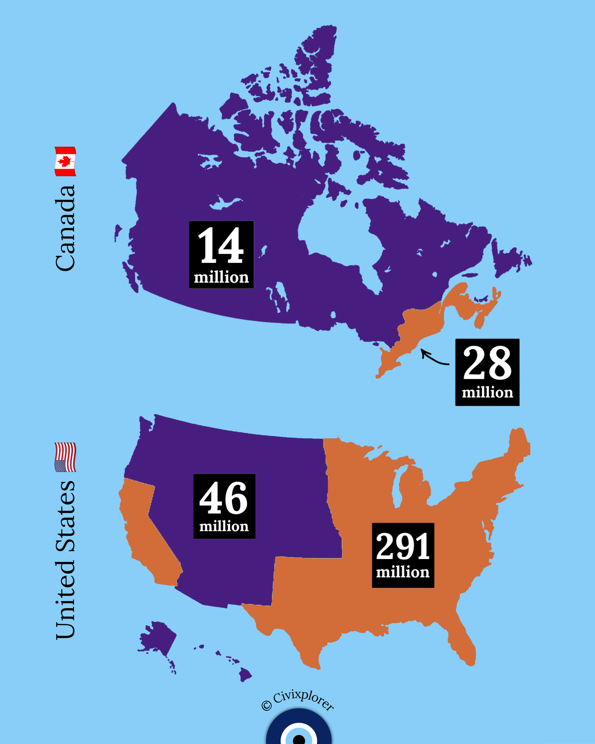
Island and continental nations showcase similar geodemographic clustering. In Indonesia, over half of the national population is packed onto the island of Java, where fertile volcanic soils and historical trade routes sustained dense urban development despite representing only a fraction of the country's archipelago. Similarly, in Australia and Canada, harsh climate boundaries push human settlement toward the outer margins. Australia's population clusters heavily along its southeastern coastline, leaving the vast interior Outback largely unpopulated due to severe aridity. In Canada, nearly two-thirds of the population lives along the southern border and the Great Lakes–St. Lawrence corridor, avoiding the frigid northern expanse and Canadian Shield.
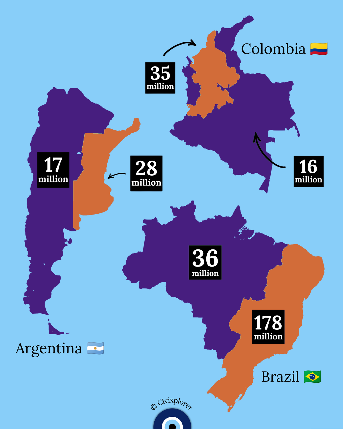
Across northern Eurasia and South America, physical barriers continue to shape population density. In Russia, the Ural Mountains separate European Russia from Asian Russia; milder climates and historical trade hubs keep the vast majority of Russians west of the Urals, while Siberian ice and permafrost limit large-scale settlement in the east. In Pakistan, settlement overwhelmingly follows the fertile Indus River basin through Punjab and Sindh. Meanwhile, in Brazil, colonial maritime history and agricultural coastal plains drew hundreds of millions to the Atlantic-facing southeast, leaving the dense Amazon rainforest and interior savannas far less populated. Ultimately, these global patterns demonstrate that human societies adapt to natural boundaries, clustering where nature provides the essential foundation for life and growth.

Comments (0)
Join the Conversation
Login to share your thoughts with the community.
Login to Comment