
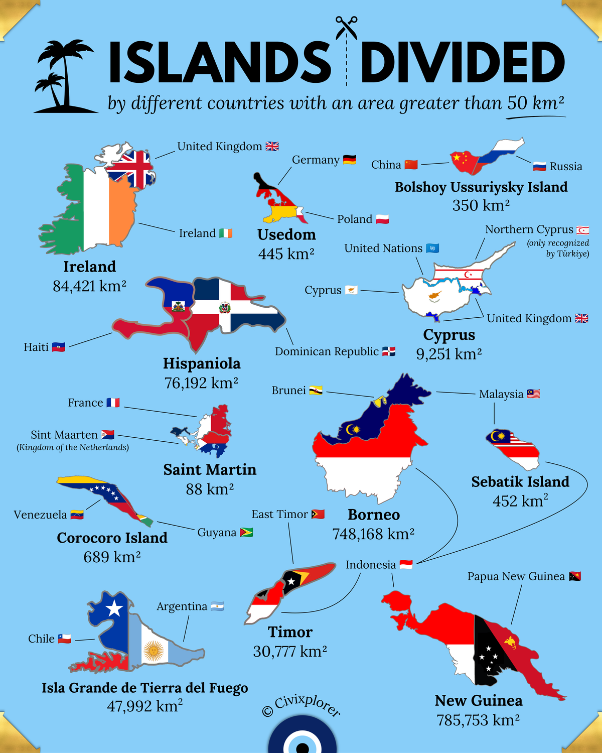
The intersection of physical geography and political geography often creates clear-cut boundaries, with coastlines serving as the natural limits of a nation’s territory. However, a fascinating exception exists: divided islands. These are single landmasses surrounded by water but partitioned by international borders. While islands typically encourage a sense of unity, historical accidents, colonial treaties, and wars have carved these landmasses into separate political entities.
New Guinea: The World’s Largest Partition
Covering approximately 785,753 km², New Guinea is the second-largest island on Earth and the largest to be divided. The island is split almost perfectly in half along the 141st meridian. The western portion is administered by Indonesia, a legacy of Dutch colonial rule, while the eastern half is the independent nation of Papua New Guinea, which emerged from former British and German territories. This border cuts through one of the most culturally and linguistically diverse regions on the planet, often disregarding the indigenous populations that have inhabited the island for millennia.
Borneo: A Three-Way Sovereignty
Borneo is a unique cartographic curiosity as the only major island shared by three sovereign states. The southern and central regions, known as Kalimantan, belong to Indonesia. The northern coastal states of Sabah and Sarawak are part of Malaysia, while the small, oil-rich Sultanate of Brunei sits as an enclave on the northern coast. This complex division is a direct result of 19th-century Anglo-Dutch rivalry, where colonial spheres of influence were eventually solidified into the national borders we see today.
Cyprus: The Most Geopolitically Intricate
Perhaps no island features a more complicated division than Cyprus. While the Republic of Cyprus is the internationally recognized government, the island’s northern region is the de facto Turkish Republic of Northern Cyprus, recognized only by Türkiye. Separating these two is a United Nations buffer zone known as the Green Line. Adding to the complexity, the United Kingdom retains two Sovereign Base Areas (Akrotiri and Dhekelia) from its colonial era, making Cyprus a theater where multiple international interests and unresolved conflicts converge.
Historical Legacies in the Caribbean and Atlantic
The island of Hispaniola serves as one of the few examples where an island is split between two fully sovereign nations: Haiti in the west and the Dominican Republic in the east. Their division stems from 17th-century European territorial grabs between France and Spain. Similarly, the island of Ireland remains partitioned between the Republic of Ireland and the United Kingdom (Northern Ireland), a division rooted in centuries of national and religious identity struggles rather than distant colonial decree.
Small Islands, Big Stories
Even smaller islands can host international frontiers. Saint Martin in the Caribbean is shared by France and the Netherlands, maintaining one of the oldest peaceful border treaties in existence. In Europe, Usedom is split between Germany and Poland as a result of post-World War II border adjustments. These examples prove that physical geography does not determine political geography. Borders are human creations—lines drawn on maps that can divide forests, mountains, and communities, leaving a lasting mark on the landscape of our world.

Comments (0)
Join the Conversation
Login to share your thoughts with the community.
Login to Comment